
Tuesday 30 November 2010


Friday 26 November 2010

Thursday 25 November 2010

figure ground of Hagia Sophia

The first one shows the relation between neighbourhoods and mosque in Constantinapole, whie the second demostrates current Istanbul.
minority ethnic communities

Main minority ethnics includes Greeks, Jews, Ameniams and Lavantines. The diagram shows there locations and their neighbourhoods. Actually, some areas are mixed with several ehnics.


Monday 22 November 2010
various locations of gated communities in Istanbul (which have the form of a tower)

During the last 20 years in the city of Istanbul, stressing the contradictions emerged in the city due to it uncontrolled, non planed and speculative growth.Just having a look towards the big new districts of Istanbul, the results of such unrestrained urban growth are more than evident: overcrowding of the urban environment, increase of the social class differences, disappearance of the characteristics of the original inhabitants, and social rootlessness of the new residents coming from Anatolia. Here are some examples of gated developments that act as communities-towers.
The photos are taken from the personal blog of Pablo Martínez Muñiz, Spanish artist / photographer based in Istanbul and Valencia.
Sunday 21 November 2010
Friday 19 November 2010
Housing types along the defined axis
Happen to find this essay "The Transformation of House Types in Istanbul in Relation to the Socio-cultural Changes", may help us study topology of Istanbul.
Thursday 18 November 2010


Neighbourhoods in history and contemporary istanbul

This diagram shows historic neighborhoods in istanbul and their situation and social function in contemporary Istanbul.
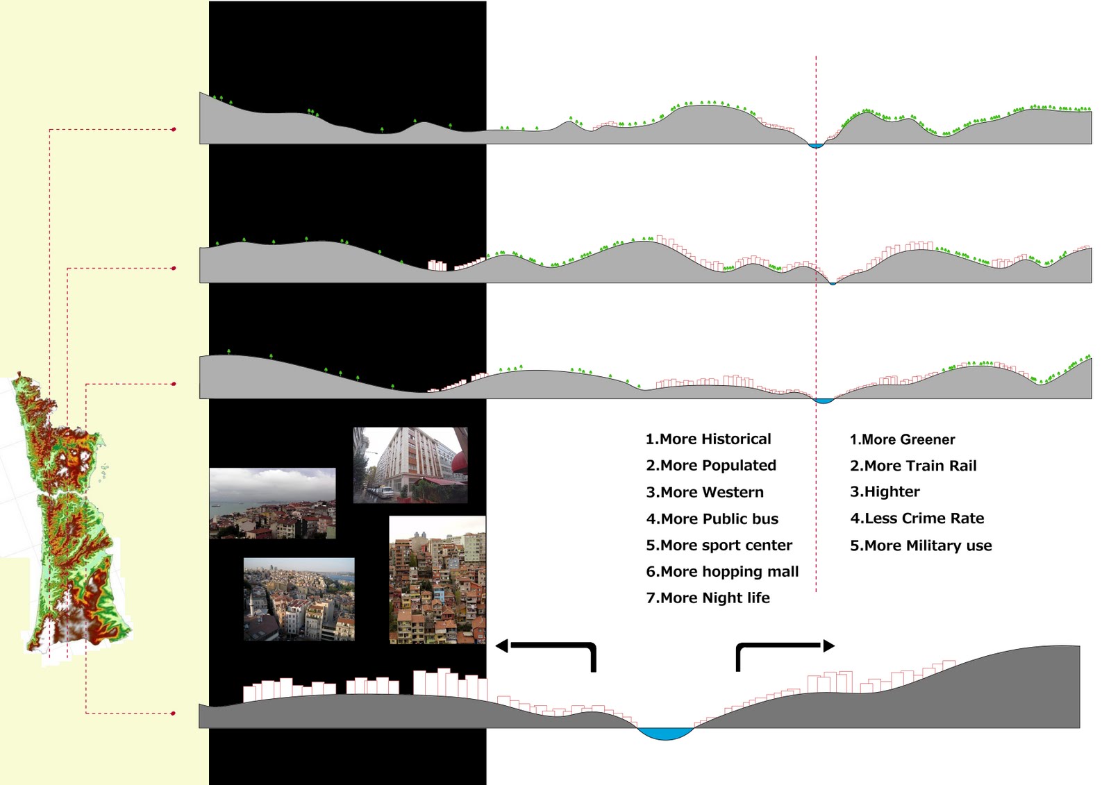
Topography & Density

According to maps, mostly shoreline and lower levels occupied by people and mountainous areas and northern forest are preserved from house developing.
Accessibility to Waterfront

After 1950, Istanbul was growing as a ‘linear city’, due to rapid and unplanned urban growth, the linear pattern of urban development altered some parts of the city, and a new pattern which disregarded the natural characteristics of the site became dominant. Therefore, the role of water and the function of the city’s waterfronts got disrupted to a great extent. The city dwellers were deprived of a close contact with water, as they used to be in the recent past. Water was no longer accessible as it used to Be, both visually and for recreation purposes.


Roles of Bosporus

As can be seen Bosporus Sea has served a multifunctional role in Istanbul. It not only joins the Europe and Asia but also, connect Russia to Mediterranean countries. It has been a great source income and people always benefit from strategic location of Istanbul. In the past, Bosporus was the protection wall for Istanbul and nowadays it is a tourist attraction for this city.
The occupational profiles of neighbourhoods in Istanbul (1990&2000)


Two figures found from the essay "The Impact of Globalisation on Different Social Groups: Competitiveness, Social Cohesion and Spatial Segregation in Istanbul", which illustrate the where different economiacal social groups are housing.
multi-layered city
 "Empirical Construction, Istanbul," by Julie Mehretu, ink and acrylic on canvas.
I think this image is really expressing the multi-layered identity of Istanbul.The complexity of Julie Mehretu's drawings translate into image the layers and data of the everyday life. It's like trying to deconstruct the different elements of the urban life and put them back together resulting in a complex urban labyrinth with great dynamics.
Subscribe to:
Posts (Atom)